Life afterwards
Port, airport and ferry terminals
The region depends on a small number of port, airport and ferry terminals. A magnitude 9 megathrust model finds every bridge to Vancouver International Airport damaged, cutting road access for the first few days. The same model puts some Vancouver-area port service out for one to two weeks.
Last reviewed
At a glance
Modelling of a magnitude 9 megathrust puts one to two weeks of disrupted service at some Vancouver-area ports, road access to the airport cut for the first few days because every bridge leading to it is damaged, and moderate liquefaction damage at the port areas on the delta.
Expected disruption: One to two weeks at some ports
Source: Study of Impact and the Insurance and Economic Cost of a Major Earthquake in British Columbia and Ontario/Québec ↗ · Insurance Bureau of Canada / AIR Worldwide · Oct 2013
No published work states what these facilities would face in a shallow crustal earthquake; the one study that assesses them models the megathrust and nothing else.
Source: Study of Impact and the Insurance and Economic Cost of a Major Earthquake in British Columbia and Ontario/Québec ↗ · Insurance Bureau of Canada / AIR Worldwide · Oct 2013
Airport road access could be cut for days
Vancouver International Airport sits on Sea Island, in the mouth of the Fraser. Everything that drives to it crosses a bridge.
Modelling of a magnitude 9 megathrust, run for the insurance industry in 2013, expects road access to the airport to be cut off during the first few critical days after the earthquake, because all of the bridges leading to it are damaged. The Arthur Laing Bridge, the main connection between the airport and the city, is expected to suffer moderate damage, may need to be closed for a few days for inspection and initial repair, and may take a few weeks to restore fully. The Canada Line rail service to the airport is likely to be disrupted as well. Those bridges are the same story as every other crossing in the region, which is transportation.
Runways may also be damaged. Sea Island is at moderate risk of liquefaction, saturated soil losing its strength and behaving like a liquid while the ground shakes, and that is the likely source of damage to the runways. Areas of tarmac are expected to be moderately damaged, with minor settlement or heaving of the surface, and some sections of runway may be out of service for a few days.
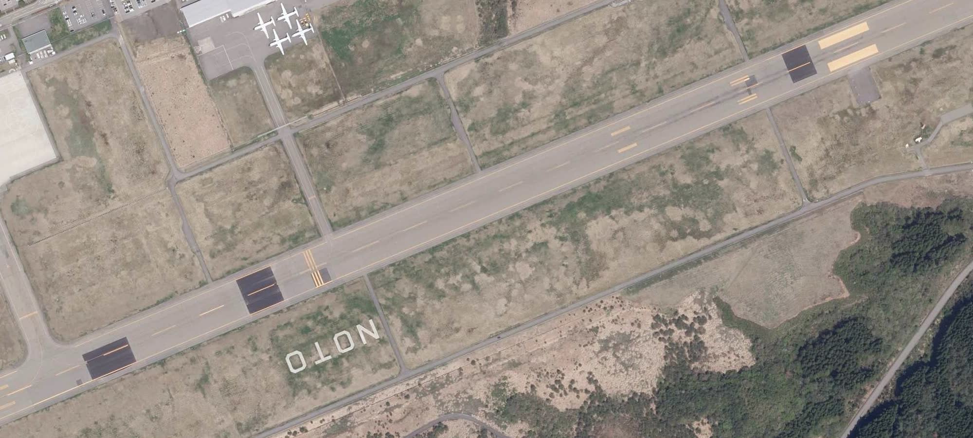
Terminals, towers and hangars are expected to sustain “slight to moderate damage”, and some masonry structures may take a few months to restore. Airport infrastructure loss across the region is put at more than $300 million.
Harbour ports fare better than delta ports
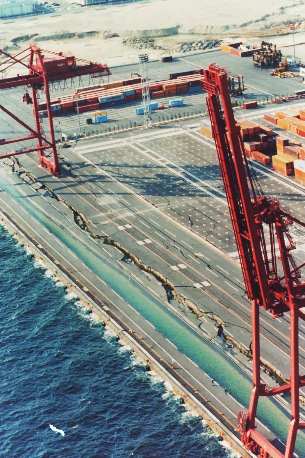
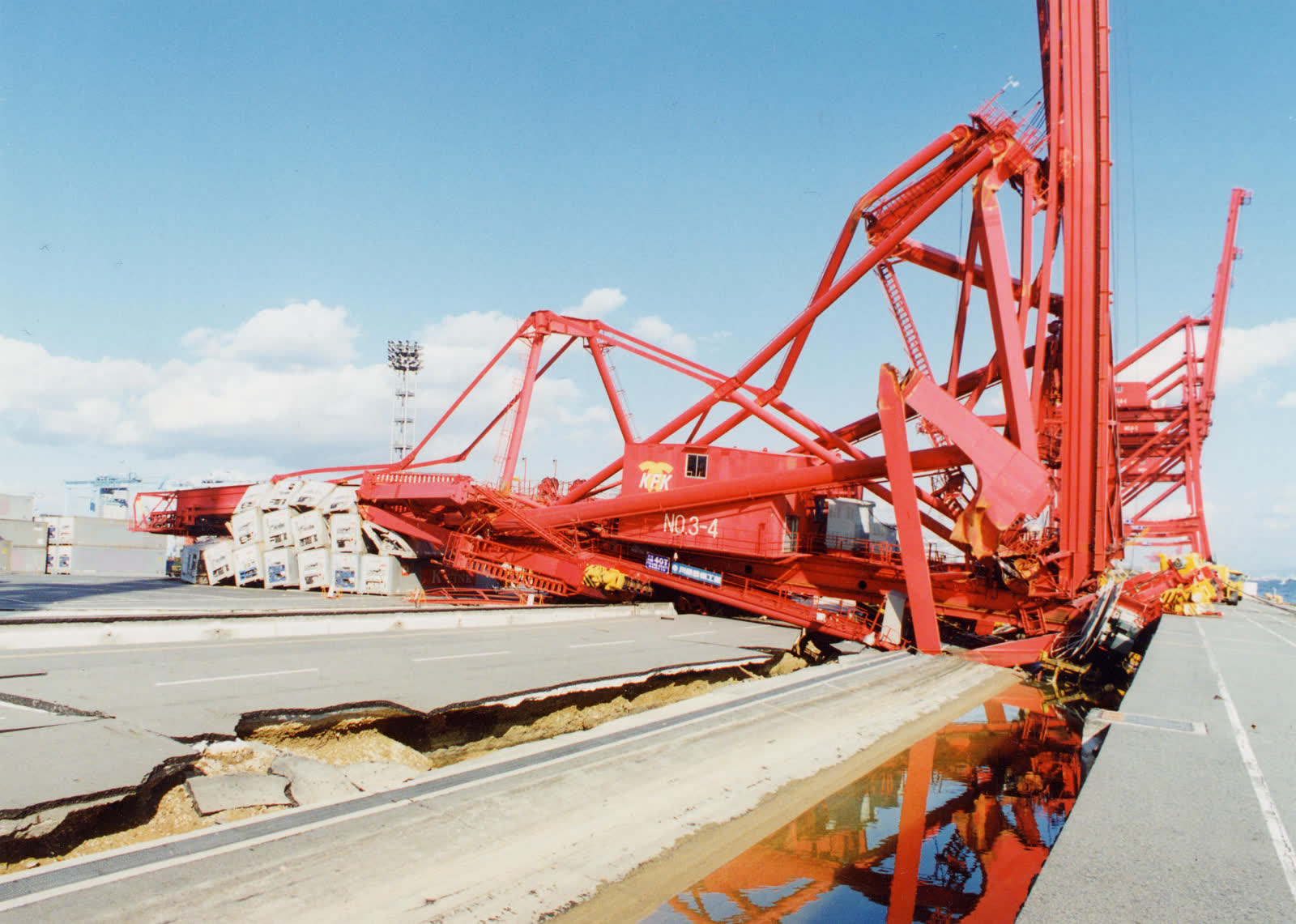
Vancouver Harbour comes out at slight damage: minor ground settlement, minor cracks in the piles, cracks on the wharf surface. Unanchored cranes may derail or go out of alignment and need minor repair before working again; anchored equipment is expected to stay functional.
The ports near Richmond, Delta and Surrey come out at moderate damage, from liquefaction: considerable settlement and cracking of piles, notable derailment of cranes, and wall cracking in port buildings. Annacis Island and North Delta are where the liquefaction damage is particularly notable.
One damage grade separates them, and what it grades is the ground, not the terminals. Service in some Vancouver-area ports may be disrupted for one to two weeks. Approximately $647 million a day in cargo moves through the Port of Vancouver. A container crane is an electric machine, so a terminal that has realigned its cranes is still waiting on electricity.
The harbour’s better grade belongs to a regional model, and it does not clear every facility on that shoreline. A geotechnical memorandum filed with the port authority for Seaspan’s Vancouver Shipyards, on the north shore of Burrard Inlet, finds the site underlain by loose sands prone to liquefaction and to large displacements in earthquakes with return periods below those current building codes recommend. On what stands there now:
“it is Westmar’s understanding that most existing facilities at the site are likely not designed to withstand kinematic loads and soil flow loads due to liquefaction of surrounding soil.”
That is an engineer reporting what the owner understands, not an inspection finding, and it covers one industrial boat basin, not the harbour.
Port traffic also depends on demand
A retrospective of the 1995 earthquake in Kobe, Japan, records that the port, “Japan’s leading container shipping port, was heavily damaged and repairs took almost a year to complete”. It also records that while the city’s economy had largely recovered by 1999, “one notable exception is the Port of Kobe which permanently lost container shipping business to other Asian ports”. Kobe is an illustration, and it forecasts nothing here.
Tsawwassen terminal has no published seismic assessment
BC Ferries’ renewal program at Horseshoe Bay includes improving seismic safety across all three berths. Horseshoe Bay sits on rock at the mouth of Howe Sound; Tsawwassen sits on the Fraser delta.
The one Lower Mainland ferry facility whose operator says in writing that it falls short is not a terminal. In a regulatory filing, BC Ferries describes its Fleet Maintenance Unit in Richmond, where the fleet is serviced, as having buildings “with a wide range of structural, seismic and hazardous-material deficiencies” and as “a facility site that does not meet current seismic codes and is susceptible to inundation during future sea level rise”. That is a yard, not a berth. It is on the delta, and it is where the vessels get fixed.
Current ferry terminals have not been assessed publicly
None of the figures above comes from anyone inspecting a wharf, a crane or a runway. They are the output of a catastrophe model, a computer simulation insurers use to estimate what an event would cost, which AIR Worldwide ran in 2013 for the Insurance Bureau of Canada, against the infrastructure as it stood then. No operator, regulator or engineer has published an assessment of the terminals, container cranes, pile-supported wharves or runways that are in use.
The one local marine facility with a published federal seismic review is the one that has not been built. Natural Resources Canada reviewed the seismic design of Roberts Bank Terminal 2 and published its review. The review panel for the same project listed the mechanism: seismic activity could affect it through “shaking damage of buildings, cranes, wharves and the causeway overpass”, including “loss of main road access to the terminal due to failure of the existing causeway”. The way in is the weak point there too.
A consulting engineer’s curriculum vitae, filed with that same panel, records seismic and liquefaction assessment work on the Deltaport Berth 3 expansion. The findings were not published.
The crustal earthquake remains unassessed
What this page says about the megathrust rests on that one study, and the study modelled the magnitude 9 megathrust and nothing else. What the port, the airport and the ferry terminals would face in a shallow crustal earthquake close to the city has not been published by anyone. That gap in the public record says nothing about whether the nearer earthquake would be gentler.
The province’s crustal planning scenario does name two of them, as exposure and not as damage: “Liquefaction of roadways in Richmond and Delta may make driving difficult, which may compound impacts to Vancouver International Airport and Tsawwassen Ferry Terminal.” That says the roads to both run over ground that can liquefy. It says nothing about either facility, and nothing about how long either would be out.
What you can do
The one published model puts some port service out for one to two weeks, and road access to the airport out for the first few critical days. What a household can do about that is decide in advance not to depend on either.
- Do not build a plan around flying out, sailing out, or someone arriving that way to help in the first days. Goods and people reach this region through a small number of very large places, and there is no local substitute for any of them.
- Plan household supplies for a long break in deliveries. What reaches a shop and what reaches a fuel pump both come through these places, and food and fuel set out what the province expects of each.
Nothing here is a repair a household can make. What is in reach is planning the days afterwards without the way in or the way out.
The full preparedness planSources on this page
Numbered in the order they are cited. Each entry links back to where it is used.
- [1]ReportStudy of Impact and the Insurance and Economic Cost of a Major Earthquake in British Columbia and Ontario/QuébecInsurance Bureau of Canada / AIR Worldwide · 2013Open the document ↗
- [2]ReportProvincial Earthquake Immediate Response StrategyMinistry of Emergency Management and Climate Readiness, Province of BC · 2022Open the document ↗
- [3]ReportBoat Basin North East Infill and JSS Load-Out — Seismic ConsiderationsVancouver Fraser Port Authority permit archive · 2019Open the document ↗
- [4]Analogue event1995 Kobe Earthquake 10-Year RetrospectiveRMS · 2005Open the document ↗
- [5]ReportEssential Infrastructure Renewal Program at Horseshoe Bay Terminal gets underwayBC Ferries · 2025Open the document ↗
- [6]ReportSupplemental Filing … For the Fleet Maintenance Unit Site Redevelopment ProjectBritish Columbia Ferry Services Inc. · 2023Open the document ↗
- [7]ReportWritten Submission for the RBT2 Public HearingNatural Resources Canada · 2019Open the document ↗
- [8]ReportReport of the Review PanelFederal Review Panel / Impact Assessment Agency of Canada · 2020Open the document ↗
- [9]ReportList of Presenters and Experts … and Supporting Curriculum VitaesVancouver Fraser Port Authority, via the federal impact assessment registry · 2019Open the document ↗