The shaking
Ground conditions
The ground beneath a building changes how it shakes. Fraser delta soil can lose its strength, while the deep Georgia Basin makes slow shaking stronger.
Last reviewed
The same earthquake can shake two places differently
The downtown peninsula and the North Shore slopes sit on rock. Richmond, Delta and the filled edges of False Creek sit on softer ground laid down by the Fraser River. Two nearby addresses can respond differently because of what lies beneath them.
Rock carries earthquake waves differently from deep sediment. Loose, wet delta soil can also lose its strength during strong shaking. These are separate effects, and both matter in Metro Vancouver.
Delta soil can lose its strength
Liquefaction happens when strong shaking raises the pressure of water between grains of loose sand. The sand stops carrying the weight above it and the ground temporarily behaves like a thick liquid. Foundations can tilt, roads can sag and buried pipes can rise or break.
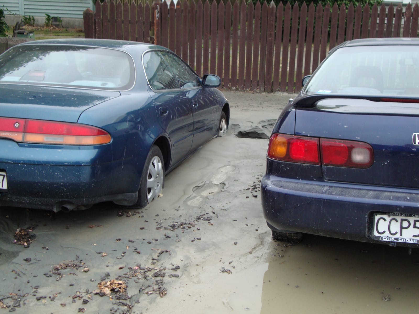
Richmond and Delta have the three conditions liquefaction needs: loose sand, shallow groundwater and strong earthquake shaking. Soil tests found many metres of material that could liquefy, with groundwater generally within a few metres of the surface. The soft deposits beneath the delta range from less than 20 m to more than 200 m thick.
Researchers estimate that the shaking needed to start liquefaction in Richmond and Delta occurs, on average, every 100 to 250 years. That is not an earthquake schedule or an estimate of how often visible damage will occur. Soil can begin to liquefy below ground without leaving damage at the surface.
For a Cascadia earthquake above magnitude 8.9, the estimated chance of liquefaction across the area studied is 31 to 57 per cent. The range applies to the study area, not every property on the delta.
The same mechanism affects more than buildings. It can damage roads, buried services and the ground beneath dikes. The Dikes page covers the sections Richmond has had analysed.
The Georgia Basin strengthens slow shaking
Beneath much of Metro Vancouver is the Georgia Sedimentary Basin, a deep bowl of soft sediment. It amplifies slow earthquake waves, the kind that make tall buildings sway.
At a shaking period of two seconds, the provincial assessment estimates average amplification of 1.7 times where the basin is 1 to 2 km deep and 2.63 times where it is 3 to 4 km deep. At one test site in the City of Vancouver, accounting for the basin raised the expected shaking at that period by 24 per cent. These factors apply to that speed of shaking and those basin depths. They are not general multipliers for every earthquake wave.
The offshore Cascadia earthquake produces the long, slow waves that the basin amplifies. This is one reason it can be especially important for tall buildings, even though a nearby crustal earthquake produces more intense shaking in much of the city.
The sixth-generation Canadian seismic hazard model and the 2020 National Building Code do not explicitly account for basin effects. Detailed local mapping helps show the variation that the national model leaves out.
Neighbourhood maps show where these effects are strongest
The Metro Vancouver Seismic Microzonation Mapping Project has published 29 maps for the western part of the region. They show variations in shaking, basin depth, liquefaction and landslide susceptibility at neighbourhood scale.
The maps do not yet cover the whole region. A second phase for Pitt Meadows, Maple Ridge and Langley is scheduled for completion in late 2026.
The official maps are free to read at metrovanmicromap.ca. They are the best place to compare the ground beneath specific neighbourhoods.
What you can do
- Look up the ground beneath home and work. The official maps show neighbourhood-scale differences across the western municipalities. Two places used by the same household may sit on very different ground.
- On the delta, plan for damaged roads and buried services as well as buildings. Liquefaction can affect the route home and the pipes beneath it. In the nearby earthquake scenario, driving may be difficult in Richmond and Delta, particularly near the airport and Tsawwassen ferry terminal.
- Ask how a tall building’s assessment accounts for local ground. Slow shaking becomes stronger in the Georgia Basin, and the 2020 National Building Code does not explicitly account for that effect.
Sources on this page
Numbered in the order they are cited. Each entry links back to where it is used.
- [1]ReportHolocene to modern Fraser River delta review, Canadian Journal of Earth SciencesCanadian Science Publishing · 2024Open the document ↗
- [2]ReportJavanbakht et al., performance-based liquefaction hazard mapping, Soil Dynamics and Earthquake EngineeringElsevier · 2024Open the document ↗
- [3]ReportJavanbakht, Molnar, Sadrekarimi & Ghofrani, paleo-liquefaction back-analysis, Earthquake SpectraEarthquake Engineering Research Institute · 2023Open the document ↗
- [4]ReportDCRRA Appendix C, Case Study 3 (Georgia Basin amplification; Kakoty & Molina Hutt, UBC) and Case Study 4 (VCH hospital portfolio; Kaur & Molina Hutt, Orr, White), plus Appendix A on method limitsEMCR / ECS, Province of BC · 2025Open the document ↗
- [5]DatasetMetro Vancouver Seismic Microzonation Mapping ProjectWestern University / ICLR, with BC EMCR · 2017Open the document ↗
- [6]ReportProvincial Earthquake Immediate Response StrategyMinistry of Emergency Management and Climate Readiness, Province of BC · 2022Open the document ↗